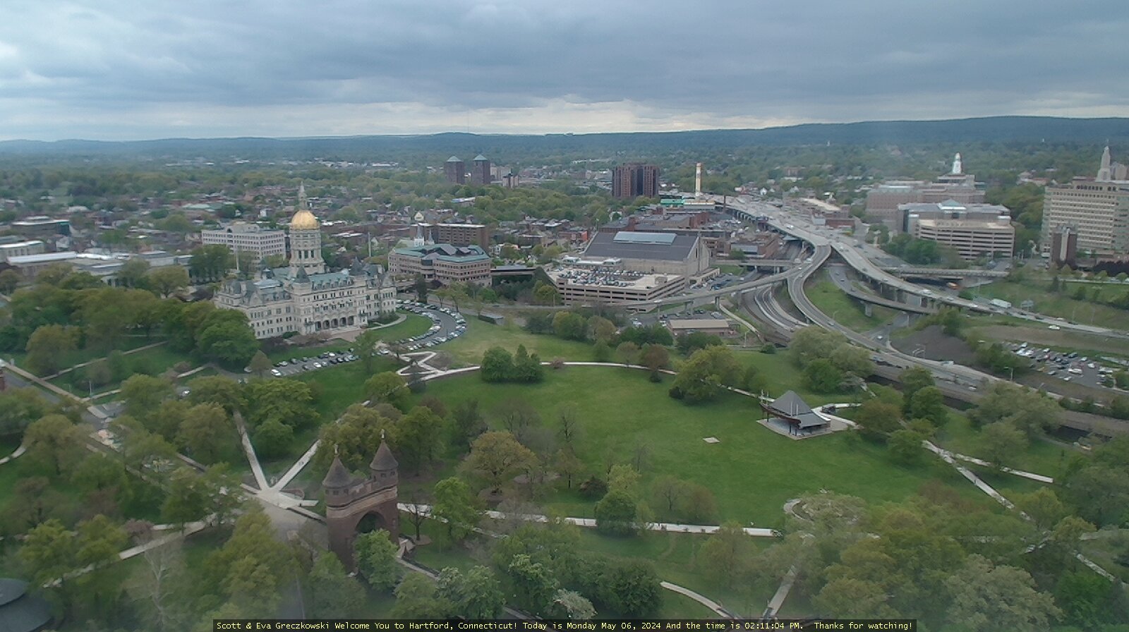
Live Conditions from Miami Avenue
Updated:
03-Aug-2026 @ 9:05am
(0 sec ago)
Temperature
Current Conditions
Forecast / Storm Prediction
Currently Outside:
74.4°F
Feels like:
93.0°F Comfortable
High Today 75.9°F
4:23 AM
Low Today 72.4°F
7:22 AM
Yest High 84.5°F
12:57 PM
Yest Low 71.9°F
3:22 AM
Sta* High 91.8°F
2024
Sta* Low 54.9°F
2025
* This Station's Records Since 5/2012
Rec* High 98.0°F
1930
Rec* Low 46.0°F
1956
* Records from Weather Underground
Mostly cloudy, Stopped raining
Wind:
W
0.6 Gusting to: 0.0 mph
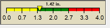
Rain: 1.42 in
Current CBI Fire Danger: -1.4 of 100
Today
Patchy Fog
Tonight
Patchy Fog then Partly Cloudy
Tuesday
Mostly Sunny
Hi 81°F
Lo 62°F
Hi 84°F
Dew Point
Liquid Precipitation
Wind Speed
Sun/Moon
Current:
73.5°F
Last Hour:
+1.3°F
High 4:23 AM:
75.0°F
Low 7:19 AM:
71.0°F
Record High:
84.0°F on
Jun-23-2025
Record Low:
-31.0°F on
Feb-2-2013
Wetbulb:
73.8°F
Rain Today
Today:
1.42 in
Storm Rain:
1.42 in
Yesterday:
0.00 in
Last 7 Days:
3.64 in
Aug Rain:
1.42 in
Aug to Date Avg:10
0.13 in
Aug to Date Diff from Avg:10
1.29 in
Aug Avg:
3.02 in
Diff from Avg:
1.60 in
Season:1
26.27 in
YTD Avg:11
22.30 in
YTD Diff from Avg:11
3.97 in
Last Rain Time/Date:
Aug-3-2026
at 8:53 AM
74 rain days in 2026
1 day in August
0 days since last rain
Current:
W
0.6 mph
1Hr Average:
0.7 mph
Wind Run:
10.64 miles
Wind Gust
Current:
0.0 mph
Today:
15.0 mph 6:55 AM
Month:
15.0 mph
3-Aug
Year:
29.0 mph
14-Mar
Record Gust:
56.0 mph
Mar-30-2021
Sunlight:
14 h 21 m 25 s of Sunlight Yesterday 14 h 19 m 16 s of Sunlight Today
Which is 2 min 9 sec shorter than yesterday 14 h 17 m 5 s of Sunlight Tomorrow (Noon ?>)(Midnight
Waning Gibbous
75%
Illuminated
Humidity
Barometer
Current:
97%
Last Hour:
1%
High 3:44 AM:
97%
Low 12:00 AM:
92%
Record High:
100%
Mar-12-2013
Record Low:
0%
Jun-2-2019
Current:
29.731 inHg
Last Hour:
Steady
High 12:04 AM:
29.835
Low 6:47 AM:
29.701
Record High:
30.953 inHg
Apr-27-2013
Record Low:
28.623 inHg
Feb-7-2020
Cooling Degree Days
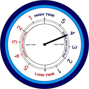
Tide
Heat Index
Air
Today:
3.8
Aug:
27.5
2026 to Date:
587.2
Heating Degree Days
2026 to Date:
3505.7
4 hours, 7 minutes to low tide at Rocky Hill 01:17 PM EDT
1 Rain season: Jan 1st to Dec 31st.
5 Estimated amount of water needed to replace the water used by plants and evaporation from the past week. (Negative numbers mean amount of water needed, positive numbers mean excess water is present).
6 Air Quality Index is provided by Connecticut EPA and is updated hourly between the hours of 6AM and Midnight.
9 Solar Index represents either an absolute scale of solar energy (W/m²) using the station’s recorded maximum or a percentage of computed theoretical solar maximum using the station’s location and time of day. These indices differ most when the sun is low on the horizon. The current scale is shown, and will toggle if it or the icon is clicked.
10 Historical average only to day 3 of just the month of August for this station since 2013.
11 Historical average rain this season to day 3 of August for this station since 2013.
NWS Weather Forecast -
Outlook Today & Tonight
Today
Patchy Fog
Hi 81°F
NWS forecast: Patchy fog and showers and thunderstorms before 9am, then patchy fog and a slight chance of showers and thunderstorms between 9am and 10am, then patchy fog and showers and thunderstorms between 10am and 3pm, then patchy fog and a slight chance of showers and thunderstorms between 3pm and 4pm, then patchy fog and a chance of showers and thunderstorms. Some of the storms could produce heavy rain. Mostly cloudy, with a high near 81. Southwest wind 2 to 14 mph, with gusts as high as 24 mph. Chance of precipitation is 100%. New rainfall amounts between 1 and 2 inches possible. Local Miami Avenue Station Forecast:Mostly cloudy and cooler, precipitation possible within 12 hours, possibly heavy at times, windy.
Tonight
Patchy Fog then Partly Cloudy
Lo 62°F
NWS forecast: Patchy fog and a chance of showers and thunderstorms before 9pm. Partly cloudy, with a low around 62. West wind 3 to 12 mph. Chance of precipitation is 40%. New rainfall amounts less than a tenth of an inch possible.
NWS Short Term Weather Forecast
Tuesday
Mostly Sunny
Tuesday Night Mostly Cloudy
Wednesday
Chance Rain Showers
Wednesday Night Chance Showers And T-Storms then Slight Chance Showers And T-Storms
Thursday
Slight Chance Rain Showers then Chance Showers And T-Storms
Thursday Night Chance Showers And T-Storms
Friday
Mostly Sunny then Chance Showers And T-Storms
Hi 84°F
Lo 62°F
Hi 83°F
Lo 68°F
Hi 87°F
Lo 71°F
Hi 88°F
ajax-dashboard6.php - Version 6.95i - 08-Jul-2026 - Script by: Scott of BurnsvilleWeatherLIVE.com
Now supported by Saratoga-weather.org Download