


Select NOAA-NWS Forecast Office Text Products
(Product availability varies with seasons, forecast office, and weather.)
Forecast Discussion for New York City/Upton, NY
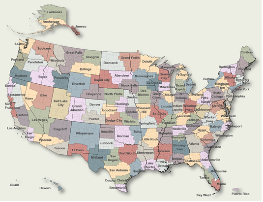
To Select Another NWS Office Click on Map or Choose from List
|
| Select Forecast Office: | Select Product: |
695
FXUS61 KOKX 030655
AFDOKX

Area Forecast Discussion
National Weather Service New York NY
255 AM EDT Mon Aug 3 2026

.WHAT HAS CHANGED...
NYC added to flood watch.

&&

.KEY MESSAGES...
1) Periods of showers with embedded thunderstorms through late
this afternoon into early this evening. Rainfall will be heavy
at times. A Flood Watch is in effect for northern New Jersey and
NYC through early this evening.

2) High surf and high rip current risk expected for the ocean
beaches through this evening.

3) Unsettled weather at times once again Wednesday and Thursday
this week.

&&

.DISCUSSION...
.KEY MESSAGE 1...
No big changes in the forecast today as an upper trough and
associated surface frontal system interact with anomalously
high precipitable water (PW). Much of the guidance, as is
supported by latest mesoanalysis, support PW values falling
just short of 2.5". This will not be too far off from the all-
time high of 2.62" August 19, 1955.

00Z HREF and WPC Urban Rain Rate Dashboard (URRD) show the peak
rainfall window across the area this morning into early this
evening. Both show about a 30 percent membership of hourly
rainfall rates of 1"+. Once you go higher than that, the
probabilities fall off to almost 0. That being said, the
combination of a moisture-laden airmass along with large scale
synoptic lift, points to several hours of moderate to heavy
rainfall along with possible south to north training. As such,
NYC was added to the flood watch for NE NJ. Elsewhere, 1-hour
FFG is nearly 2 inches, so have held off. There could still be
isolated instances of flash flooding outside the watch area. WPC
still has most of the area under a slight risk of excessive
rainfall.

Coverage will likely decrease from west to east this afternoon
as the vertical wind profile begins to veer to the SW with
drier air moving in. A cold front will then pass through late
this afternoon into early this evening.

SPC also has the area under a marginal risk for severe weather
with a 5% for the wind threat. Mid level lapse rates are
generally less than 6c (weak), but there is moderate CAPE and
decent vertical wind shear to support something isolated.

High pressure and dry weather is on tap for Tuesday.

Scattered showers and thunderstorms return Wednesday through
Friday as the western Atlantic ridge retrogrades, sending the
dissipating frontal boundary into the area.

.KEY MESSAGE 2...
Both Wavewatch and NWPS guidance have long period southerly
swells of 8-11 ft 9s today which supports a high surf advisory
for the ocean beaches and dangerous rip currents in the surf
zone. Surf will range from 6 to 10 ft, highest across the
Suffolk County ocean beaches.

There could be another high risk of rip currents for Suffolk
ocean beaches Tuesday with otherwise a moderate risk of rip
currents for the ocean beaches. For Tuesday, the winds will be
decreasing to near 5-10 kt from northerly in the morning to more
southerly in the afternoon. Ocean southerly swells decrease
Tuesday to near 4 ft with near 7 second period.


.KEY MESSAGE 3...
Scattered showers and thunderstorms return Wednesday through
Thursday as the western Atlantic ridge retrogrades, sending the
dissipating frontal boundary into the area. PW values will close
in on 2 inches. Localized heavy rainfall will be possible.

&&

.AVIATION /06Z MONDAY THROUGH FRIDAY/...
A slow moving frontal system will impact the terminals through
Monday. A weak warm front continues to push north tonight, followed
by a cold frontal passage Monday evening.

Widespread MVFR and IFR conditions continue into Monday morning.
Thunderstorm chances increase after 06Z. LIFR conditions are likely
for KGON and possible for KISP into early Monday morning. All
terminals becoming MVFR late Monday morning and then gradually VFR
through the day from west to east.

Southerly winds increase to 10 to 15 kt tonight. Coastal
terminals may gust up to 20-25 kt tonight, highest confidence
is at KISP. Gusts pick back up to 20 to 25 kt by Monday morning
for all terminals and likely last through the afternoon. Winds
lower to 10 kt or below and become N/NW Monday evening behind
the cold frontal passage. Low chance of LLWS for KISP and KGON
early Monday morning into the afternoon.

 ...NY Metro (KEWR/KLGA/KJFK/KTEB) TAF Uncertainty...

AMD likely with changing flight cats through the TAF period.

Most likely TSRA timing is included in TEMPO groups. An isolated
thunderstorm outside of those times can not be completely ruled out,
mainly after 06z Monday through Monday evening.

.OUTLOOK FOR 00Z TUESDAY THROUGH FRIDAY...

Monday night: Becoming VFR. Winds shifting to the NW-N at 5-10 kt.

Tuesday: VFR.

Wednesday-Friday: Sub-VFR at times in showers and thunderstorms.

Detailed information, including hourly TAF wind component forecasts,
can be found at: https:/www.weather.gov/zny/n90

&&

.MARINE...
Small craft conditions are forecast for the ocean and some
eastern non-ocean zones today with south winds of 15 to 25 kt
and gusts up to 30 kt. Highest winds will be across the eastern
ocean waters. Challenge is how much of the winds aloft get down
to the surface. A few gusts to 35 kt on the eastern ocean
waters can`t be ruled out. Small craft conditions will likely
continue for the ocean through tonight as the winds veer more to
the SW and seas remaining elevated around 5 to 7 ft. Sub
advisory conditions should develop thereafter.

&&

.OKX WATCHES/WARNINGS/ADVISORIES...
CT...None.
NY...Flood Watch through this evening for NYZ072>075-176-178.
     High Risk for Rip Currents from 6 AM EDT this morning through this
     evening for NYZ075-080-081-178-179.
     High Surf Advisory from 6 AM this morning to 9 PM EDT this
     evening for NYZ075-080-081-178-179.
NJ...Flood Watch through this evening for NJZ002-004-006-103>108.
MARINE...Small Craft Advisory until 8 PM EDT this evening for ANZ331-
     332-340-345.
     Small Craft Advisory until 6 AM EDT Tuesday for ANZ350-353.
     Small Craft Advisory until midnight EDT tonight for ANZ355.

&&

$$

DISCUSSION...DW
AVIATION...JT
MARINE...DW
|
Previous Forecast Discussions may be found at
NWS New York City/Upton, NY (OKX) Office Forecast Discussions.
(Click 'Previous Version' there to view past versions successively.
Some may differ only in time posted.)
Products Courtesy of NOAA-NWS
NWS Information Parsing Script by Ken True at Saratoga Weather - WFO and Products Scripts by SE Lincoln Weather.
Mapping by Curly at Michiana Weather and by Tom at My Mishawaka Weather.