


Select NOAA-NWS Forecast Office Text Products
(Product availability varies with seasons, forecast office, and weather.)
Forecast Discussion for New York City/Upton, NY
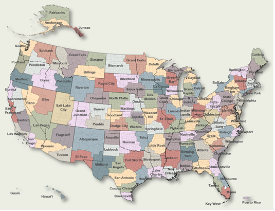
To Select Another NWS Office Click on Map or Choose from List
|
| Select Forecast Office: | Select Product: |
990
FXUS61 KOKX 122000
AFDOKX

Area Forecast Discussion
National Weather Service New York NY
400 PM EDT Thu Jun 12 2025

.SYNOPSIS...
A cold front slowly pushes through tonight and stalls just south of
the area on Friday. A weak low pushes along the boundary late
Friday night and pushes through early on Saturday. High pressure
off the New England coast tries to build towards the area
Sunday into Monday as waves of low pressure move along the
stalled boundary to our south. The high weakens on Tuesday
allowing the front to begin returning northward through next
Thursday.

&&

.NEAR TERM /THROUGH FRIDAY/...
A cold front approaches and pushes through during the overnight.
Questions remain as to the degree of convective initiation just
ahead and along the boundary, which some convective allowing models
(CAMs)show taking place. There are some subtle timing differences
along with disagreement in actual occurrence. The region will be
just south or on the southern periphery of a jet axis which swings
through far Northern New England into Southern Canada. Therefore
there should be sufficient shear to support convective storm
organization if convection actually gets going. However, there
remains a strong conditionality component to any convection as
forecast soundings continue to indicate some capping at multiple
levels. Also with timing differences and many CAMs hinting at a
later time for shower or potential thunderstorm initiation, CAPE
should wane some as we get away from the daytime hours and later in
the evening and night. Now, if some convection can get going any
storms would likely contain strong gusty winds with solid DCAPE
values, along with the potential for hail. The greater chance
appears to be for the western third of the region where
instability is progged to be higher and peaks at 1000-1500 J/kg
during the early to mid evening. With some mid-level warm air
being indicated by forecast soundings updrafts may struggle to
accelerate with some storms perhaps staying sub severe. Trends
in the CAMs will continue to be monitored as SPC has a Marginal
risk of sever weather for a portion of the region from basically
the NYC metro on west. Some of the experimental CAM guidance
has suggested a better convective, or at least an occasional
shower chance late in the overnight and into Friday morning.
Will highlight a low end chance PoP for the marginal risk area
further west during the early to mid evening, with another
slight chance PoP time period for a more widespread portion of
the region into Friday morning. Temperatures overnight will
average close to or just above the seasonal norms with mainly
60s for lows.

Questions remain abound for the day Friday. The cold front which is
progged to move through Thursday night is not progged to get very
far to the south and is expected to stall nearby, perhaps just to
the immediate south. At the same time high pressure attempts to
ridge down, at least temporary from the northwest before the next
impulse attempts to approach from the west towards late in the day
and evening. Also the upper level jet gets further downstream to the
northeast as the region should get in-between any mid and upper
level support / forcing mechanisms. Low end chance to slight chance
PoPs appear prudent for the day Friday, although the consensus of
NWP guidance keeps the region dry much of the day. More of an
onshore flow is expected into Friday afternoon with some uncertainty
as to how much the onshore flow can penetrate into western most
areas. With some cloud cover and more of an onshore flow
temperatures should be cooler with mainly upper half of the 70s to
lower 80s for daytime highs.

&&

.SHORT TERM /FRIDAY NIGHT THROUGH SATURDAY/...
During Friday night with the frontal boundary stalled nearby and
perhaps just south of the area expect disturbances to more or less
ride along the boundary. Occasional showers looks to take place
during Friday night. The column is forecast to saturate further into
later in the overnight and into early Saturday morning. Instability
appears to be limited Friday night into Saturday, thus will carry
high end chance to low end likely PoPs for weather across the region
late Friday night into Saturday morning. During the day Saturday it
doesn`t appear to be a complete washout, as after the disturbance
from the morning gets through most NWP guidance suggests a relative
break or pause in any shower activity. Thus, have included low end
chance PoPs Saturday afternoon. Suffice it to say that the start of
the weekend will feature more in the way of clouds, with a period or
two of unsettled weather with the potential for showers. With the
onshore flow progged to continue on Saturday with a E-ENE wind in
the boundary layer expect temperatures to average below normal. Max
temperatures will likely only reach the upper 60s to perhaps some
lower and middle lower 70s.

&&

.LONG TERM /SATURDAY NIGHT THROUGH THURSDAY/...
No significant changes were made to the long term Saturday night
through next Thursday.

Key Points:

*While there is a chance for showers through the period, it will
not be a complete washout.

*Difficult to time waves of low pressure and moisture interactions
with the stalled boundary to our south will  ultimately determine
when/if showers occur across parts of the  area Saturday night
through early next week.

*The stalled boundary starts retreated northward later Tuesday
through Thursday continuing the chance for showers, possibly a
thunderstorm.

*Temperatures will average below normal Sunday and Monday then
return to more seasonably warm levels Tuesday with potential of
warmer than normal conditions mid to late week.

The region will lie on the southern periphery of the westerlies for
much of the long term period with ridging holding across the
southern US. A frontal boundary will remain stalled across the
Middle Atlantic. The main forecast challenge Saturday night through
Monday will be from difficult to time waves of low pressure on the
stalled front as well as an subtle shortwaves in the middle level
flow. Surface ridging will also try to take hold over the area,
which may limit how much shower activity can develop. Model trends
have been leaning in this direction, especially for Sunday into
Monday with increasing chances for mostly dry conditions. The upper
ridging may start building along the eastern seaboard Tuesday and
Wednesday allowing the boundary to lift back to the north as a warm
front. A more organized shortwave may then start approaching towards
next Thursday which may also bring in another cold front, but this
remains uncertain given it is a week out.

Rainfall amounts and any impacts appear limited at this time with
any greater chance of convection potentially occurring mid week as
conditions warm up and instability starts increasing. There will
likely be adjustments to PoPs and timing of any potential convection
once the mesoscale environment becomes better resolved.

&&

.AVIATION /20Z THURSDAY THROUGH TUESDAY/...
A weak cold front slowly passes through early this evening.

VFR. Only an isolated shower/thunderstorm at most will be
possible until 01-02z. Still can`t rule out a shower and iso
TSTM later tonight into the Friday morning push as well, however
confidence is not high enough to include in TAFs at this time.

W to SW winds 10-15kt with gusts 16-20kt. Winds then shift NW-N
this evening.

 NY Metro (KEWR/KLGA/KJFK/KTEB) TAF Uncertainty...

Showers/tstms may be only isolated at most or not occur at all.

Chance that KJFK does not shift to around 210 true late this
afternoon. If winds do shift more southerly, winds could shift
back to SW-W near 23-00z.

Winds may vary from around 220 through 300 true all afternoon
for KEWR/KTEB/KLGA.

Shift to NNW-N for all terminals may be off by 1-2 hours.

.OUTLOOK FOR 18Z FRIDAY THROUGH TUESDAY...

Friday aftn/evening: VFR.

Friday overnight-Saturday: MVFR/IFR with chance of showers.

Sunday: MVFR with showers possible.

Monday: Chance of showers and MVFR/IFR.

Tuesday: Mainly VFR.

Detailed information, including hourly TAF wind component forecasts,
can be found at: https:/www.weather.gov/zny/n90

&&

.MARINE...
Sub advisory conditions are anticipated for all waters through the
first half of the weekend. Ocean seas generally hold at 2 to 3 ft
with a relaxed pressure gradient and a light onshore flow. Winds
and seas are expected to remain below SCA levels from Saturday
night through next Tuesday with a weak pressure gradient in place.

&&

.HYDROLOGY...
There are no hydrologic concerns through the short and near term.
There is the low chance of a few isolated thunderstorms, but any
localized hydrologic impact should be minimal. Also, there are
no hydrologic impacts expected throughout the long term period.

&&

.TIDES/COASTAL FLOODING...
A moderate rip current risk continues through this evening. The risk
becomes low on Friday with a light easterly flow and limited swell.
There is a moderate rip current risk on Saturday with increasing
easterly flow and building seas 3 to 4 ft.

&&

.OKX WATCHES/WARNINGS/ADVISORIES...
CT...None.
NY...Air Quality Alert until midnight EDT tonight for NYZ067>075-
     078>081-176>179.
NJ...Air Quality Alert until 11 PM EDT this evening for NJZ004-006-
     103>108.
MARINE...None.

&&

$$

SYNOPSIS...JE/DS
NEAR TERM...JE
SHORT TERM...JE
LONG TERM...DS
AVIATION...JC
MARINE...JE/DS
HYDROLOGY...JE/DS
TIDES/COASTAL FLOODING...
|
Previous Forecast Discussions may be found at
NWS New York City/Upton, NY (OKX) Office Forecast Discussions.
(Click 'Previous Version' there to view past versions successively.
Some may differ only in time posted.)
Products Courtesy of NOAA-NWS
NWS Information Parsing Script by Ken True at Saratoga Weather - WFO and Products Scripts by SE Lincoln Weather.
Mapping by Curly at Michiana Weather and by Tom at My Mishawaka Weather.